
Know Your Land.
Build With Confidence.
Professional Land Surveying and Geospatial Mapping with 20+ years of experience. Built on precision and integrity.
Services
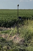
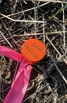
Not sure exactly where your property lines are? A boundary survey helps you know what you own and where your property begins and ends. At LAH Surveying & Geospatial, we research property records, review existing deeds and plats, locate property markers and other evidence in the field, and use precise measurements to determine your property boundaries. We then provide a clear survey showing the location of your property lines and any relevant findings, such as potential encroachments. A boundary survey can be helpful when you're buying or selling property, building a fence, planning an addition or other improvement, preparing for construction, or simply wanting peace of mind about your property boundaries. Know your property. Protect your investment. Contact LAH Surveying & Geospatial today to discuss your project and request a boundary survey.
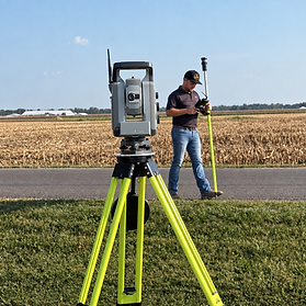
Before you design, build, grade, or improve your property, you need to know what you're working with. A topographic survey gives you a clear picture of your property's existing elevations and features so you can make informed decisions and plan your project with confidence. At LAH Surveying & Geospatial, we combine precise fieldwork, modern surveying technology, and careful attention to detail to provide dependable information you can build on. Our goal is to make the surveying process straightforward while giving you and your project team the accurate site information needed to move your project forward. Topographic surveys are commonly used for new construction, additions, site development, grading and drainage projects, engineering and architectural design, and property improvements.
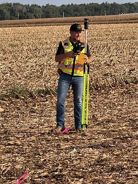
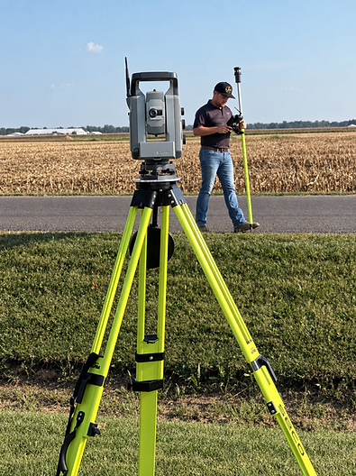
When it's time to build, accuracy matters. Construction staking helps ensure that your project is being built in the right location and according to the approved plans. At LAH Surveying & Geospatial, we provide precise field layout services utilizing state-of-the-art Survey Instruments to help contractors and construction teams confidently place buildings, foundations, utilities, roads, grades, and other project features where they belong. Using accurate measurements, we help turn plans into reliable points in the field.
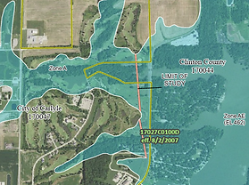
If your property is in a FEMA-designated Special Flood Hazard Area, an Elevation Certificate documents your structure's elevations relative to the Base Flood Elevation (BFE) — information your insurance company and lender rely on. At LAH Surveying & Geospatial, we complete floodplain surveys and Elevation Certificates using precise field measurements and current FEMA flood mapping data. We gather the required elevation details, complete the certificate accurately, and provide the documentation you need for flood insurance, lending, and building permit requirements. Whether you're purchasing a home in a flood zone, refinancing, or resolving a flood insurance dispute, we can help you get the documentation you need. Contact LAH Surveying & Geospatial today to request a Floodplain Survey or Elevation Certificate.
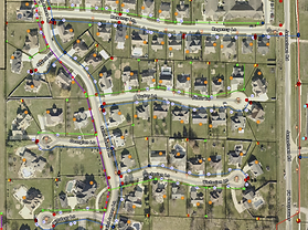
LAH Surveying & Geospatial provides geospatial and GIS services that help you map, organize, analyze, and manage information about your property, infrastructure, and projects. We combine surveying expertise with ESRI GIS technology to create accurate digital maps and location-based data that make complex information easier to access and understand. Our services include GIS mapping and database development, asset and utility mapping, field data collection, GIS hosting services, spatial analysis, property mapping, aerial and imagery mapping, data conversion, and customized GIS solutions. Depending on your project needs, deliverables may include digital GIS maps, interactive maps, GIS databases, shapefiles, geodatabases, CAD files, asset inventories, georeferenced imagery, and customized mapping products.
Projects
(Under Construction)
Regional Service Area
- Bond
- Clinton
- Fayette
- Jackson
- Jefferson
- Madison
- Marion
- Monroe
- Montgomery
- Perry
- Randolph
- St. Clair
- Washington
13 Illinois Counties
(Fully Licensed To Perform Survey & Geospatial Work Statewide In Illinois)
Request A Survey
(Free Estimates)
- 1Site
- 2Scope
- 3Contact